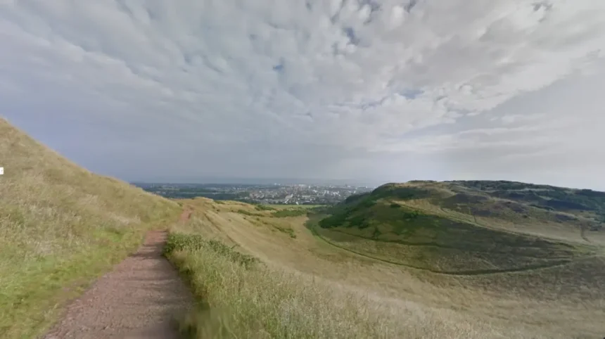
Edinburgh’s volcanic landscape originated approximately 350 million years ago during the Early Carboniferous period when tectonic plate collisions triggered intense magmatic activity across the Midland Valley of Scotland, pushing molten basaltic rock upward through ancient sedimentary layers to form durable volcanic plugs and sills.
- How Did Pleistocene Glaciation Sculpt the Modern Topography of Edinburgh?
- Why Did Castle Rock Become the Defensive Center of Early Edinburgh?
- How Did the Crag-and-Tail Formation Dictate the Layout of the Old Town?
- How Did Volcanic Valleys Influence the Creation of Edinburgh’s New Town?
- How Did Local Volcanic Stone Shape Edinburgh’s Architecture and Construction?
- How Do Arthur’s Seat and Calton Hill Function in Modern Urban Edinburgh?
During the Carboniferous period, the landmass that forms modern Scotland sat near the equator under tropical conditions. Shifting tectonic plates fractured the Earth’s crust along the Southern Upland Fault and the Highland Boundary Fault. Magma forced its way toward the surface through these structural weaknesses.
Some magma erupted violently through volcanic vents, while other intrusions cooled slowly beneath layers of sandstone and shale. Over tens of millions of years, wind, water, and tectonic uplift stripped away the softer sedimentary rock surrounding these volcanic formations.
The remaining igneous rocks consist primarily of dark basalt and dolerite, which possess high mineral density and resistance to weathering. Geologists classify these formations as volcanic plugs, which represent the solidified magma chambers of extinct volcanoes, and sills, which are horizontal sheets of igneous rock injected between sedimentary strata.
Arthur’s Seat and Castle Rock represent prominent volcanic plugs, while Salisbury Crags forms a massive dolerite sill. This geological foundation established the dramatic vertical relief that defines the modern urban topography of Edinburgh.
How Did Pleistocene Glaciation Sculpt the Modern Topography of Edinburgh?
Pleistocene glaciers advancing eastward across Scotland during the Quaternary Ice Age carved deep valleys around Edinburgh’s resistant volcanic plugs, creating distinct crag-and-tail formations that dictated the city’s drainage basins, ridge lines, and habitable plateaus for future human settlement.
Beginning roughly 2.6 million years ago, massive ice sheets up to 1,000 meters thick moved across central Scotland from west to east. As the glacial ice encountered the hard basalt plugs of Castle Rock and Arthur’s Seat, the ice split and flowed around the obstructions.
The immense pressure and abrasive debris embedded in the glacier scoured deep troughs on the northern and southern flanks of the volcanic cores. These glacial troughs later became the Nor Loch valley and the Cowgate ravine.
Behind the protective shield of the hard volcanic plugs, the glacier deposited long, sloping ridges of softer glacial till and sedimentary rock. Geologists term this landform a crag-and-tail structure.
Castle Rock serves as the steep western crag, while the sloping ridge extending eastward toward Holyrood Palace forms the tail. This natural ramp provided the only accessible gradient for constructing roads and buildings, directly determining the layout of Edinburgh’s historic Royal Mile.
Why Did Castle Rock Become the Defensive Center of Early Edinburgh?
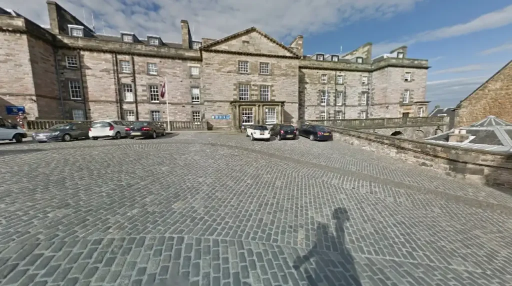
Castle Rock provided an isolated basalt volcanic plug rising 80 meters above the surrounding glacial valleys with sheer vertical cliffs on three sides, offering prehistoric tribes and medieval Scottish monarchs an impregnable natural fortress that anchored the development of Edinburgh.
Archaeological excavations confirm human occupation on the summit of Castle Rock dating back to the Late Bronze Age around 900 BCE. The Votadini tribe, a Brythonic Celtic people, established a fortified hillfort known as Din Eidyn on the volcanic crag during the Iron Age.
The sheer dolerite cliffs on the north, west, and south sides prevented enemy armies from mounting frontal assaults. Attackers could only approach the summit via the narrow, steep eastern ridge, which defenders easily fortified with stone walls and gatehouses.
During the seventh century, King Edwin of Northumbria captured the stronghold and renamed the settlement Edwinesburh. In the twelfth century, King David I transformed the fortress into a royal residence and established the adjacent burgh along the eastern crag tail. Edinburgh Castle endured 26 documented sieges over 1,100 years, making it the most besieged place in Great Britain.
The defensive security guaranteed by this volcanic formation attracted merchants, craftsmen, and religious institutions to settle directly beneath its walls.
How Did the Crag-and-Tail Formation Dictate the Layout of the Old Town?
The narrow eastern tail extending from Castle Rock forced medieval Edinburgh builders to construct densely packed, multi-story stone tenements along a single central spine, creating the famous Royal Mile and establishing one of Europe’s earliest high-rise urban environments.
Bounded by the marshy Nor Loch to the north and the steep ravine of the Cowgate to the south, the Old Town possessed severely limited horizontal building space. The Flodden Wall, constructed in 1513 after the Scottish defeat at the Battle of Flodden, further restricted outward urban expansion for 250 years.
Because the population grew steadily inside this confined volcanic ridge, architects built upward rather than outward. Builders constructed stone tenements known as lands that reached up to 14 stories high during the seventeenth century.
Narrow alleyways called closes and wynds branched off the main thoroughfare of the Royal Mile at right angles, sloping steeply down both sides of the volcanic tail. Prominent examples include Mary King’s Close, Advocate’s Close, and Fleshmarket Close.
By 1750, approximately 30,000 residents lived within this cramped one-square-mile volcanic corridor. This extreme population density created severe sanitation challenges, frequent fires, and public health crises that eventually forced city leaders to expand beyond the volcanic ridge.
How Did Volcanic Valleys Influence the Creation of Edinburgh’s New Town?
Deep glacial valleys flanking the volcanic ridge trapped raw sewage in the stagnant Nor Loch, forcing eighteenth-century civic planners to drain the lake, bridge the ravine, and construct the neoclassical New Town on the flat sedimentary plateau north of the volcanic core.
For centuries, rainwater and household waste flowed down the steep closes of the volcanic tail directly into the Nor Loch, a stagnant body of water filling the northern glacial trough. By the mid-eighteenth century, the waterborne diseases and foul odors emanating from the valley made living conditions in the Old Town intolerable for wealthy citizens.
In 1759, the Town Council initiated the draining of the Nor Loch and commissioned the construction of the North Bridge to span the deep glacial gorge.
In 1767, architect James Craig won a design competition to plan the New Town on the gentle sedimentary slopes north of the drained valley. The New Town featured wide grid-pattern streets, public squares, and low-rise Georgian townhouses that contrasted sharply with the vertical medieval architecture of the volcanic ridge.
The drained bed of the Nor Loch eventually became Princes Street Gardens, transforming a polluted glacial trench into a central public park separating the Old Town from the New Town.
How Did Local Volcanic Stone Shape Edinburgh’s Architecture and Construction?
Quarries carved directly into Edinburgh’s volcanic sills and surrounding sandstone beds supplied durable dolerite for cobblestone streets and high-grade Craigleith sandstone for neoclassical facades, giving the city its uniform gray stone aesthetic and structural longevity.
Edinburgh builders utilized two distinct local rock types shaped by the region’s volcanic history. From Salisbury Crags and Corstorphine Hill, quarrymen extracted hard igneous dolerite and basalt.
Workers shaped this dense volcanic stone into rectangular paving blocks called setts, which paved the Royal Mile, Victoria Street, and the steep inclines of the New Town. The extreme hardness of the volcanic rock prevented wheel ruts from forming under heavy horse-drawn carriage traffic.
For building facades, masons extracted pale, fine-grained sedimentary rock from Craigleith Quarry, located three kilometers northwest of Castle Rock. Craigleith sandstone formed during the Carboniferous period alongside the volcanic intrusions, achieving high quartz content and exceptional weather resistance.
Between 1790 and 1830, Craigleith Quarry supplied stone for over 70 percent of New Town buildings, including the Royal Scottish Academy and Register House. Over time, coal smoke reacted with the mineral surface of the stone, darkening the city’s architecture to its signature charcoal hue.
How Do Arthur’s Seat and Calton Hill Function in Modern Urban Edinburgh?
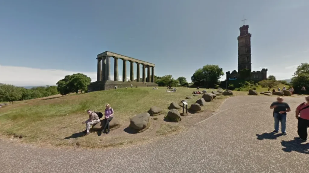
Arthur’s Seat and Calton Hill remain protected volcanic hills within central Edinburgh, serving as public green spaces, scientific landmarks, and elevated viewpoints that preserve natural biodiversity and restrict high-rise modern construction across the historic skyline.
Rising 251 meters above sea level inside Holyrood Park, Arthur’s Seat represents the largest eroded volcanic complex in central Edinburgh. The Scottish Parliament maintains Holyrood Park as a 640-acre protected historic environment containing rare basalt cliff flora, three freshwater lochs, and four Iron Age hillforts.
Calton Hill, situated at the eastern end of Princes Street, rises 103 meters and consists of Carboniferous basalt lava flows and volcanic ash layers. Calton Hill houses the City Observatory, the National Monument of Scotland, and the Nelson Monument.
These volcanic elevations directly govern modern urban planning regulations in Edinburgh.
The City of Edinburgh Council enforces strict skyline protection policies that prohibit skyscrapers from obstructing sightlines to Castle Rock, Arthur’s Seat, and Calton Hill. Additionally, Holyrood Park functions as a vital ecological sanctuary within an urban center of 526,000 residents, supporting over 350 plant species and attracting more than three million visitors annually.
Is Arthur’s Seat in Edinburgh an active volcano?
No, Arthur’s Seat is an extinct volcano that last erupted approximately 350 million years ago during the Carboniferous period. Geologists confirm that the tectonic plate boundaries responsible for Scotland’s ancient volcanic activity shifted away millions of years ago, eliminating any possibility of future eruptions in Edinburgh.
Why is Edinburgh Castle built on a rock?
Edinburgh Castle sits on Castle Rock because the 80-meter basalt volcanic plug provided natural vertical cliffs on three sides, making it nearly impossible for ancient armies to attack. Early settlers chose this volcanic formation for defense, and Scottish kings later expanded it into a royal fortress.
What is the difference between Edinburgh Old Town and New Town geology?
Edinburgh Old Town sits atop a narrow, steep volcanic crag-and-tail ridge formed by hard basalt and glacial debris, resulting in tall, tightly packed buildings. In contrast, the New Town sits on a flat sedimentary sandstone plateau north of a drained glacial valley, allowing for wide streets and low-rise Georgian architecture.
How old are the volcanic rocks in Edinburgh?
The volcanic rocks forming Castle Rock, Arthur’s Seat, and Calton Hill are between 340 and 350 million years old. They formed during the Early Carboniferous period when molten magma pushed through sedimentary layers before Ice Age glaciers eroded the softer surrounding rock 20,000 years ago.
Can you hike to the top of Edinburgh’s extinct volcanoes?
Yes, visitors can hike to the summits of both Arthur’s Seat and Calton Hill via maintained public footpaths in central Edinburgh. Arthur’s Seat takes approximately 45 to 60 minutes to climb to its 251-meter peak, while Calton Hill requires a 10-minute walk up paved steps to reach its 103-meter summit.