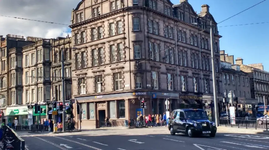
Shandwick Place Edinburgh is a major urban thoroughfare located in the western part of the city centre within the vibrant West End district. The street measures approximately 250 metres in length and forms a direct western continuation of uk/local/princes-street/">Princes Street running from the junction of Hope Street and Queensferry Street to the eastern edge of Maitland Street. This busy corridor positions itself as a primary gateway linking the commercial core of the New Town with residential and commercial zones further west.
- How did Shandwick Place Edinburgh evolve historically?
- What are the primary transport options available at Shandwick Place Edinburgh?
- What is the economic and commercial significance of Shandwick Place Edinburgh?
- How does Shandwick Place Edinburgh impact modern urban planning?
- FAQs About Shandwick Place Edinburgh
The geographical coordinates place this street firmly within the UNESCO World Heritage site designation for the Old and New Towns of Edinburgh. The northern side of the street interacts closely with the sweeping residential arcs of Coates Crescent and Atholl Crescent while the southern flank borders the dense commercial developments of the Exchange District. This unique positioning ensures that the street serves as an essential transition zone between the retail focused city center and the administrative quarters.
The physical structure consists of a wide multi modal transport corridor flanked by continuous terraces of four storey tenement and commercial buildings. The properties on either side represent classic examples of early nineteenth century urban planning designed to accommodate retail premises on the ground floors with offices or residential spaces above. The street layout manages a heavy daily flow of public transport vehicles, commercial delivery logistics, and pedestrian footfall.
How did Shandwick Place Edinburgh evolve historically?
Shandwick Place Edinburgh evolved during the early nineteenth century as an ambitious western extension of the New Town residential plan. In 1806 a landowner named John Cockburn Ross of Shandwick in Easter Ross inherited the agricultural land south of the Easter Coates House estate and decided to develop it. Ross commissioned an architect named James Tait to design a formal urban layout that would extend the grand scale of Princes Street westward.
Construction on the street layout officially commenced in 1807 alongside the parallel development of Maitland Street which was managed by Sir Alexander Charles Maitland. The street took its name directly from the ancestral estate of John Cockburn Ross to establish social prestige for the new development. The initial design intent focused on creating an affluent residential enclave complete with grand Georgian facades to attract wealthy professionals moving away from the crowded Old Town.
By 1813 construction expanded to include the adjacent Coates Crescent and Walker Street which established a rigid geometric grid system across the West End. As the nineteenth century progressed the escalating demand for central retail spaces forced a dramatic structural transformation of the original properties. Residential townhouses gradually converted their ground floors into elegant shops, bank branches, and hotel premises to cater to the expanding Victorian merchant class.
The historical identity of the street changed further with the introduction of early public transit infrastructure during the late Victorian era. Cable operated tramways were installed along the central corridor in 1888 which firmly cemented the street as a critical transportation artery rather than a quiet residential retreat. The structural integrity of these period buildings has been preserved into 2026 through strict conservation laws protecting their historical stone masonry.
What are the primary transport options available at Shandwick Place Edinburgh?
Shandwick Place Edinburgh operates as one of the most integrated public transport hubs within the City of Edinburgh council boundary. The central feature of the transport infrastructure is the West End tram stop which sits on an island platform between Coates Crescent and Atholl Crescent. This tram stop acts as a critical intermediate station on the Edinburgh Trams route which connects Edinburgh Airport to Newhaven via the city centre.
The West End tram stop features a specialized track switching point immediately to the west of the passenger platform. This mechanical infrastructure allows the stop to function as an emergency eastern terminus for the entire tram network whenever Princes Street is closed for public events. The system ensures operational continuity for passengers traveling from the western suburbs and Edinburgh Airport into the edge of the central shopping district.
Complimenting the tram system is an extensive network of bus stops managed heavily by operators like Lothian Buses and various regional coach companies. Essential city bus routes including the 3, 25, 31, and 33 stop regularly along this corridor to move commuters across the city. The street also hosts the Airlink 100 express service which provides continuous 24 hour transport links between the city centre and the airport terminal.
For rail commuters the street sits exactly 400 metres east of Haymarket station which is the second largest railway station in Edinburgh. This proximity allows passengers to disembark from national rail services and quickly transition to local buses or trams on Shandwick Place within a five minute walk. The combination of these transport systems creates an efficient interchange that mitigates the need for private vehicle usage in the central zone.
What is the economic and commercial significance of Shandwick Place Edinburgh?
The economic significance of Shandwick Place Edinburgh stems from its position as a high density retail and commercial pitch in the West End. The property portfolio along the street encompasses approximately 25,736 square feet of mixed use commercial space managed by institutional investors like Town Centre Securities. The ground floor units feature large glass shopfronts embedded into historic stone arches to attract premium retail tenants and service providers.
Karolis Pantelejevas
The retail mix on the street includes national supermarket chains, independent cafes, financial institutions, and specialized travel hubs. A prominent commercial entity on the street is the Shandwick Place TravelHub which is operated directly by Edinburgh Trams at number 49. This facility combines a customer service centre for ticketing and Ridacard management with an accessible CoffeeHub that utilizes local Scottish food suppliers.
The upper floors of the historic terraces are primarily occupied by boutique hotels, corporate offices, and dental or legal practices. This vertical mix of commercial uses guarantees a steady stream of daytime footfall from office workers alongside evening expenditure from tourists staying in the area. The economic vitality of the street remains directly tied to the operational efficiency of the tram and bus networks passing through.
Property transactions over the past decade highlight the enduring value of this real estate corridor within the competitive Edinburgh market. Institutional investors completed major commercial sales of remaining retail blocks between December 2019 and March 2022 to realign urban development portfolios. The constant commercial adaptation ensures that the street retains high occupancy rates despite broader shifting patterns in digital retail environments.
How does Shandwick Place Edinburgh impact modern urban planning?
Shandwick Place Edinburgh serves as a prime case study for modern urban planning challenges involving historical preservation and multi modal transit. The integration of the modern tramway system in 2014 required extensive utility diversions and structural reinforcement of the old roadbed. Urban planners had to balance the physical weight and vibration of modern tram vehicles with the fragile foundations of category listed buildings.
The successful adaptation of the street layout has significantly influenced the city strategy regarding pedestrian prioritization and emission reduction zones. The street features wide pavements to safely accommodate large volumes of pedestrians moving between the West End village and Princes Street. The restriction of private vehicle access along portions of the corridor has successfully reduced localized carbon emissions while optimizing public transit travel times.
The street design also showcases effective accessibility integration within an old built environment that was not originally constructed for modern mobility. The West End tram stop features level boarding platforms, tactile paving indicators, and step free access ramps to assist passengers with physical disabilities. These design principles align with the strict inclusion standards enforced by modern Scottish planning regulations across all public spaces.
The ongoing management of the street involves a careful coordination between transport operators, heritage bodies like Edinburgh World Heritage, and local business associations. This collaborative planning framework ensures that any future street furniture updates or storefront renovations respect the overarching Georgian aesthetics. The street stands as a resilient template for how historic European cities can modernize infrastructure without sacrificing architectural identity.
To explore more about historical developments and land use changes across the capital city, read about how the Archdiocese sells historic Edinburgh site. For commuters navigating regional transport disruptions affecting links toward the west, view the update on disruption to ScotRail services between Glasgow and Edinburgh.
FAQs About Shandwick Place Edinburgh
What is the closest railway station to Shandwick Place?
The closest railway station is Haymarket station which is located approximately 400 metres west of the street. It takes about five minutes to walk between the two locations along a flat pavement corridor.
Which tram stop serves Shandwick Place directly?
The West End tram stop serves this street directly and is located on an island platform between Coates Crescent and Atholl Crescent. This stop connects passengers directly to Edinburgh Airport and Newhaven.
Is Shandwick Place included in the UNESCO World Heritage zone?
Yes, Shandwick Place is entirely included within the New Town boundary of the Old and New Towns of Edinburgh UNESCO World Heritage site. The properties are protected by strict architectural conservation laws.
What facilities are available at the Shandwick Place TravelHub?
The TravelHub located at 49 Shandwick Place provides transport ticketing services, Ridacard top ups, and travel information. It also features an accessible cafe called CoffeeHub with free Wi-Fi access.
Can private cars drive freely down Shandwick Place?
Private car access is heavily restricted along sections of Shandwick Place to prioritize buses, trams, and taxi services. Drivers must follow local traffic signage to avoid entering designated public transport corridors.