Calton Hill stands as a prominent volcanic landform and historic precinct situated in central Edinburgh, Scotland. Rising 103 meters above sea level, this landmark forms a critical component of the UNESCO World Heritage designation of the city. The site integrates neoclassical architecture with natural topography, establishing a central public space.
The physical location of the hill places it directly at the eastern terminus of Princes Street. It contains several national structures, scientific observatories, and civic memorials that reflect the intellectual expansion of the Scottish Enlightenment.
What Is the Historical Significance of Calton Hill in Edinburgh?
Calton Hill represents the architectural transformation of 19th-century Edinburgh into the Athens of the North. The site evolved from a medieval barony into a public park in 1725, serving as a center for civic gatherings, scientific innovation, political demonstrations, and classical monument construction across three centuries.
The documented human usage of the hill began in the 15th century when King James II designated the surrounding slopes for archery practice and sports. The area functioned as a natural amphitheater for public theatrical performances, including early Scottish dramatic plays. A Carmelite monastery occupied the land during the early 16th century before the Scottish Reformation led to its abandonment in 1560.
The City of Edinburgh Town Council purchased 22 acres of land on the hill in 1725 to construct a public walkway. This purchase established one of the earliest municipal public parks in Scotland. David Hume arranged for the construction of Hume Walk in 1775, providing a path for citizens accessing the summit.
During the 19th century, the site became a focal point for political expression and social reform. The Chartist movement organized a demonstration on the hill in 1838, gathering thousands of citizens to petition for universal male suffrage. The physical area continues to function as a venue for cultural festivals, including the annual Beltane Fire Festival held every April.
Which Famous Monuments and Structures Are Located on Calton Hill?
Calton Hill hosts the National Monument, Nelson Monument, Dugald Stewart Monument, City Observatory, and the Robert Burns Monument. These structures were built between 1776 and 1832 to commemorate military victories, scientific pursuits, and leaders of the Scottish Enlightenment.
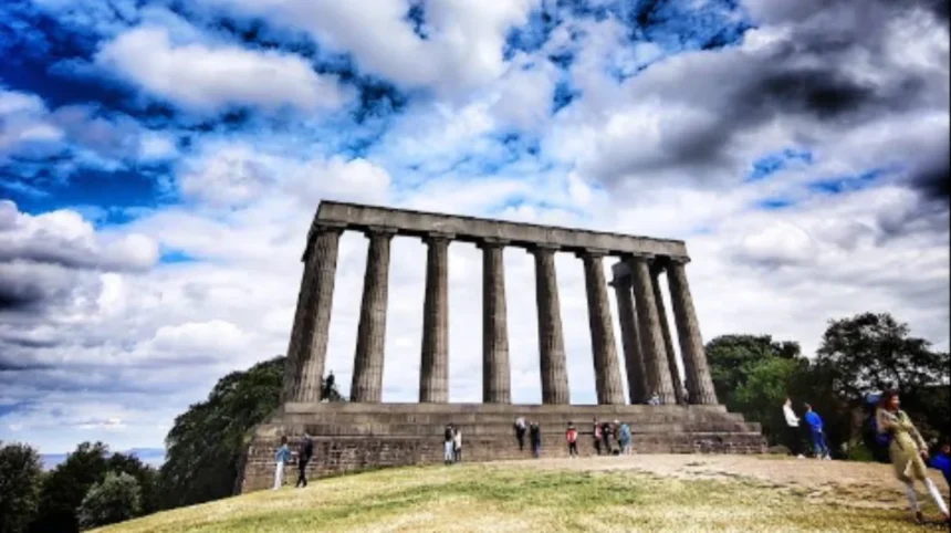
The National Monument of Scotland stands as the most prominent structure on the summit. Architects Charles Robert Cockerell and William Henry Playfair designed the structure in 1822 to mirror the Parthenon in Athens. The project intended to commemorate Scottish soldiers and sailors who died in the Napoleonic Wars.
Construction began in 1826 using Craigleith sandstone blocks weighing up to 15 tons each. Project funding relied on private subscriptions, which raised 16,000 pounds out of the required 42,000 pounds. Construction halted in 1829 due to capital exhaustion, leaving only twelve Doric columns completed.
The Nelson Monument occupies the highest natural point of the hill. Built between 1807 and 1816, the 32-meter castellated tower honors Vice-Admiral Horatio Nelson following the Battle of Trafalgar in 1805. Astronomer Charles Piazzi Smyth added a time ball to the top of the tower in 1852. The time ball drops at 1:00 PM daily to sync chronometers for ships in the Firth of Forth.
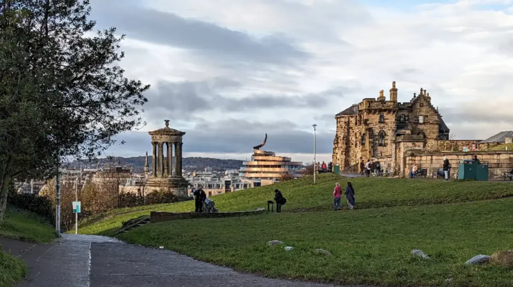
The Dugald Stewart Monument stands on the western edge overlooking Princes Street. Architect William Henry Playfair completed the structure in 1831 to honor the University of Edinburgh philosophy professor. The design adapts the circular Choragic Monument of Lysicrates in Athens, featuring nine Corinthian columns surrounding an urn.
The City Observatory complex occupies a central walled compound. Thomas Short constructed the initial Gothic Observatory House in 1776. William Henry Playfair replaced it in 1818 with a Greek Revival central observatory modeled after the Temple of the Winds. The building now operates as a contemporary art center managed by the Collective Gallery.
How Do You Access the Best Viewpoints on Calton Hill?

Accessing the best viewpoints requires climbing the paved access paths from Waterloo Place or Regent Road to reach designated viewing platforms. The locations offer 360-degree panoramic views covering Edinburgh Castle, Arthur’s Seat, Princes Street, and the Firth of Forth.
The Western Viewpoint sits directly adjacent to the Dugald Stewart Monument. This location frames the classic skyline photography angle of Edinburgh. The visual corridor aligns with Princes Street, the Balmoral Hotel clock tower, the Scott Monument, and Edinburgh Castle. Sunset provides optimal lighting for west-facing photography as the sun drops behind the castle rock.
The Southern Viewpoint overlooks the historical valley between Calton Hill and Holyrood Park. Visitors observe the Palace of Holyroodhouse, the modern Scottish Parliament building, and the volcanic crags of Arthur’s Seat. This angle displays the transition between historic architecture and natural geology.
The Northern and Eastern Viewpoints extend across the Firth of Forth toward the region of Fife. The platform provides line-of-sight views over the Port of Leith, the Royal Yacht Britannia, and coastal docks. Clear weather conditions allow visibility up to 20 miles across the estuary waters.
What Is the Strategic Role of Calton Hill in Edinburgh Urban Design?
Calton Hill serves as the eastern architectural terminus for the Georgian New Town master plan designed by James Craig in 1767. The location integrates civic governance, public transport corridors, and urban conservation zones within the metropolitan infrastructure.
The development of Regent Bridge between 1815 and 1819 connected Princes Street to Calton Hill across a ravine. Engineer Robert Stevenson oversaw the construction, creating a grand entry corridor into the Scottish capital. This infrastructure expansion enabled residential development along Regent Terrace, Royal Terrace, and Carlton Terrace.
The southern base of the hill accommodates major national administrative buildings. St Andrew’s House, constructed between 1935 and 1939 in an Art Deco style, serves as the headquarters of the Scottish Government. Adjacent to this sits the Old Royal High School, built by Thomas Hamilton in 1829 as a Greek Doric landmark.
The green space operates under strict municipal protection policies managed by the City of Edinburgh Council and Edinburgh World Heritage. The hill acts as a biological refuge for urban wildlife while maintaining pedestrian access routes connecting Waverley Railway Station to eastern residential districts.
What is the best time of day to visit Calton Hill for photography?
Early morning and late afternoon provide optimal lighting for photography. Golden hour highlights the western face of the monuments and Edinburgh Castle, while sunrise offers clear light across the Firth of Forth without large crowds.
How long does it take to walk up Calton Hill from Princes Street?
The walk takes 5 to 10 minutes along paved paths from the eastern end of Princes Street. The incline is gradual, making the summit accessible to most visitors.
Why is the National Monument on Calton Hill unfinished?
Construction stopped in 1829 after public subscriptions failed to raise the necessary funds. Only 16,000 pounds were collected out of the estimated 42,000 pounds required to complete the Parthenon design.
Is there an admission fee to access Calton Hill?
Access to Calton Hill, its grounds, and public viewpoints is free and open 360 days a year. Specific attractions like climbing the Nelson Monument tower require an admission ticket.
What is the time ball on the Nelson Monument used for?
The time ball was installed in 1852 to signal the exact time (1:00 PM) to maritime vessels anchored in the Firth of Forth, allowing sailors to calibrate their chronometers accurately.