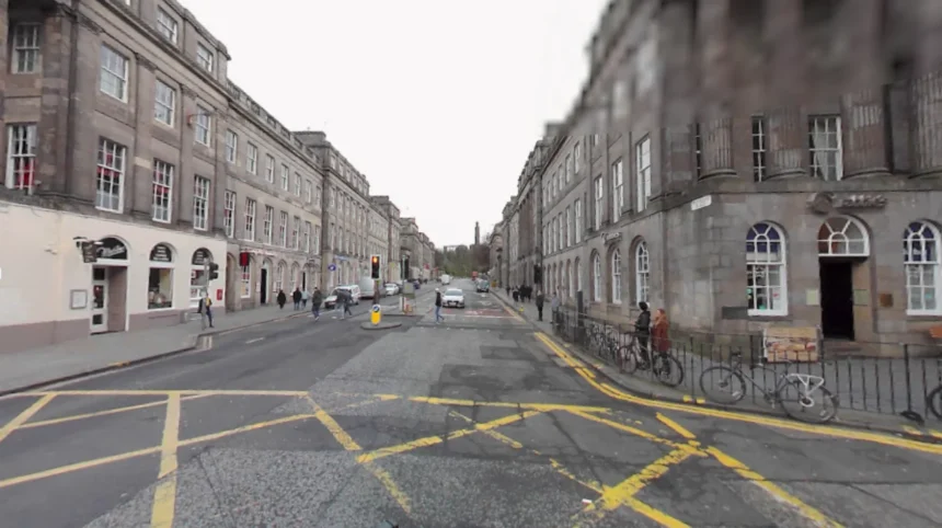
Navigating Scotland’s capital city without a personal vehicle is practical, efficient, and cost-effective. Edinburgh features a compact layout built on ancient volcanic geography, which makes driving difficult and expensive due to strict parking limits and low-emission zones. The municipality maintains an extensive municipal public transport system alongside dedicated pedestrian paths and cycleways.
- What Public Transit Options Connect Edinburgh City Centre?
- Is Edinburgh a Walkable City for Visitors and Residents?
- How Does the Edinburgh Tram System Work?
- What Are the Best Cycle Routes and Bike Rental Options?
- How Do You Travel from Edinburgh Airport Without Driving?
- Are Water of Leith and Union Canal Paths Good for Commuting?
- What Are the Rules for Taking Public Transport at Night?
Modern electric trams, comprehensive bus routes, regional rail connections, and active travel corridors provide seamless urban mobility. Travelers and residents reach every major district without operating a motor vehicle.
What Public Transit Options Connect Edinburgh City Centre?
Public transit in central Edinburgh relies on an integrated network of municipal buses, light rail trams, and heavy rail trains. Lothian Buses operates over seventy routes across the urban zone, providing high-frequency connections between commercial hubs and residential neighborhoods.
Edinburgh Trams operates a single sixteen-kilometer light rail line connecting Edinburgh Airport directly to the coastal community of Newhaven via Princes Street. National Rail operates urban and regional services out of Edinburgh Waverley and Haymarket stations. These transit modes provide comprehensive geographic coverage across the entire city metropolitan area.
Lothian Buses forms the primary backbone of urban transit in the city. The bus fleet consists of double-decker vehicles operating on dedicated bus lanes to bypass street congestion during peak hours. Services run continuously throughout the day, with specialized NightBus routes taking over between midnight and four-thirty in the morning. Edinburgh Trams operates modern low-floor vehicles with complete wheelchair accessibility.
Trams run at seven-minute intervals during peak times, stopping at major landmarks including St Andrew Square and the West End. National Rail passenger services connect central Edinburgh to outer suburbs like South Gyle, Brunstane, and Musselburgh within ten minutes of departure.
Payment for public transit is fully digitized across all main operators. Passengers use contactless debit cards, credit cards, or smart devices on Lothian Buses and Edinburgh Trams through the automated TapTapCap payment system. TapTapCap automatically calculates individual journeys and caps daily charges at five pounds and seventy pence for city zone travel.
Single adult bus and city-zone tram tickets cost two pounds and forty pence. Paper tickets are available at automated tram stop kiosks, but drivers on Lothian Buses do not carry change for cash payments. Regional rail passengers purchase digital tickets via national rail applications or physical ticket barriers at Waverley Station.
Is Edinburgh a Walkable City for Visitors and Residents?

Edinburgh ranks as one of the most walkable cities in the United Kingdom due to its compact urban footprint and historic design. The historic Old Town and Georgian New Town form a UNESCO World Heritage site where major attractions lie within short walking distances.
Princes Street Gardens separates the two primary historic districts, allowing pedestrians to traverse the city core without navigating heavy motor vehicle traffic. Royal Mile runs continuously from Edinburgh Castle down to the Palace of Holyroodhouse, spanning exactly one Scots mile of fully pedestrianized and wide-paved streets.
Walking through Edinburgh requires navigating significant vertical elevation changes created by extinct volcanic structures and glacial erosion. The city features steep gradients, public staircases, and multi-level street structures such as Victoria Street and Cowgate. Cobblestone surfaces pave historical areas including the Royal Mile, Grassmarket, and Dean Village, requiring supportive footwear for comfort and safety.
Pedestrians cross major thoroughfares safely using broad zebra crossings and signal-controlled pedestrian intersections. Signage pillars located at key street intersections provide clear walk-time estimates and geographic maps for orientation.
The city council continues to expand pedestrianized infrastructure under the ongoing Edinburgh City Centre Transformation project. Pedestrian zones restrict private vehicular access along George Street, Cockburn Street, and the Royal Mile during core operational hours. These restrictions create noise-free pedestrian corridors that improve air quality and safety.
Footpaths along the Water of Leith Walkway offer off-road walking paths spanning twelve miles from Balerno in the southwest to the Port of Leith in the northeast. Pedestrians navigate between major city destinations entirely isolated from urban vehicle traffic along these landscaped river paths.
How Does the Edinburgh Tram System Work?
The Edinburgh Trams light rail system operates on a single continuous line running from Edinburgh Airport to Newhaven. The sixteen-kilometer track features twenty-three distinct stops serving key residential, financial, and cultural zones across the urban area.
The route passes through major transport nodes including Edinburgh Gateway, Haymarket Station, Princes Street, St Andrew Square, and Ocean Terminal. Trams run on dedicated right-of-way tracks along major corridors, avoiding standard street traffic delays.
Passengers must validate their travel payment before boarding any Edinburgh Trams vehicle. Ticket vending machines at every tram platform accept contactless cards, chip-and-PIN payments, and exact cash. Passengers using contactless cards tap their card at platform validator posts prior to entering the tram carriage.
Ticket inspectors board trams regularly to verify valid paper tickets, mobile app passes, or card taps. The system splits into two main fare zones: the City Zone, which covers all stops between West End and Newhaven, and the Airport Zone, which applies specifically to journeys originating or terminating at Edinburgh Airport.
Tram carriages feature full physical accessibility standards with level platform boarding, designated wheelchair spaces, and visual-auditory stop announcements. The tram sequence integrates directly with Lothian Buses schedules to allow rapid transfers at shared interchanges such as Foot of the Walk and Haymarket.
Daily service runs from five in the morning until midnight, providing direct transit for airport travelers and city commuters alike. Passengers reach Edinburgh Airport from Princes Street in thirty-five minutes aboard the tram. The system serves as an efficient link between the city center and the maritime district of Leith.
What Are the Best Cycle Routes and Bike Rental Options?
Edinburgh contains an extensive network of designated cycleways, off-road shared paths, and converted railway paths for cyclists. National Cycle Network Route 1 and Route 75 pass directly through the city, providing protected pathways away from motorized street traffic.
The Innocent Railway Path offers a paved, car-free cycle track running from East Meadows under Arthur’s Seat to Craigmillar. The Roseburn Path and North Edinburgh Busway paths form an interconnected grid of greenways allowing cyclists to commute between northern suburbs and the city center safely.
Cyclists share designated road space using painted cycle lanes on major thoroughfares including Leith Walk and Melville Street. City authorities are installing segregated cycle lanes separated from traffic by solid concrete bollards to improve rider safety.
Navigating Edinburgh by bicycle requires preparing for varied road surfaces, including historic granite cobblestones, setts, and tram tracks along Princes Street. Cyclists crossing tram tracks must cross at a perpendicular ninety-degree angle to prevent bike wheels from catching inside the recessed rail grooves.
Bike hire services operating within Edinburgh supply traditional pedal bicycles and electric-assist pedal cycles. Private hire shops located near Haymarket, Waverley, and Leith offer daily and weekly bicycle rentals including helmets and locks.
Electric bikes provide valuable motor assistance when climbing steep inclines such as the Mound, Liberton Brae, or Waverley Bridge. Public cycle parking hoops are installed outside major public buildings, libraries, museum entrances, and railway stations. Cyclists secure bicycles using heavy-duty D-locks to prevent opportunistic theft in public areas.
How Do You Travel from Edinburgh Airport Without Driving?
Travelers arriving at Edinburgh Airport reach the city center efficiently without using private cars or rental vehicles. Edinburgh Trams provides direct rail connection from the terminal building into the heart of the city every seven to ten minutes. The tram journey to Princes Street takes thirty-five minutes, with single adult airport tickets priced at seven pounds and ninety pence.
The Airlink 100 express bus service operated by Lothian Buses offers a alternate public transit link running twenty-four hours a day directly to Edinburgh Waverley railway station.
The Airlink 100 bus operates dedicated double-decker vehicles equipped with luggage racks, free Wi-Fi, and USB charging ports. Airlink buses depart from Stance A outside the airport terminal every ten minutes during daytime hours and every fifteen minutes overnight.
The journey from the airport to St Andrew Square takes thirty minutes under typical traffic conditions. An adult single Airlink ticket costs five pounds, while an open return ticket costs eight pounds and fifty pence. Contactless card payments are accepted directly on the bus payment reader upon boarding the vehicle.
Local bus services provide affordable secondary links from the airport to non-central Edinburgh neighbourhoods. Lothian Buses route 200 connects the airport to northern residential areas and Ocean Terminal in Leith. Lothian Buses route 300 serves western districts, Heriot-Watt University, and southern residential suburbs.
These local services charge standard bus fares, making them economical for travelers heading directly to outer city accommodation. Taxis and private hire vehicles operate from dedicated pickup zones at the airport ground transportation center, though public transit remains faster during peak traffic periods.
Are Water of Leith and Union Canal Paths Good for Commuting?
The Water of Leith Walkway and the Union Canal towpath serve as primary off-road active travel corridors for pedestrians and cyclists. The Water of Leith path stretches twelve miles from the Pentland Hills at Balerno down to the docks at Leith.
The path follows the natural river valley, passing through Slateford, Dean Village, Stockbridge, and Canonmills. The surface consists of crushed stone, tarmac, and paved walkways, offering a grade-separated route entirely isolated from vehicular street traffic.
The Union Canal towpath forms a flat, paved travel corridor extending from the Basin at Lochrin Basin in Fountainbridge westward toward Falkirk. The towpath provides a continuous car-free route through residential districts including Polwarth, Slateford, and Wester Hailes.
Commuters use the towpath for walking, jogging, and cycling into the commercial business district at Exchange Crescent. The canal towpath features continuous public lighting and smooth asphalt paving within the city boundary, ensuring safe travel conditions year-round.
Both path networks intersect at the Slateford Aqueduct in western Edinburgh, allowing users to transition seamlessly between river and canal routes. Travel speeds along these shared-use paths are regulated by local courtesy codes to protect pedestrians.
Cyclists must use bike bells when approaching pedestrians and maintain slow speeds near narrow bridge underpasses. The greenway network functions as a scenic green transport network, connecting suburban populations to urban employment centers without exposure to urban air pollution or road vehicle hazards.
What Are the Rules for Taking Public Transport at Night?
Night public transportation in Edinburgh operates continuously after standard daytime services terminate at midnight. Lothian Buses operates the NightBus network, designated by an N prefix before route numbers, serving major city corridors between midnight and four-thirty in the morning.
NightBus routes depart centrally from Night Bus Hubs located on Frederick Street and George Street. These buses connect central Edinburgh to outer suburbs including Balerno, Musselburgh, Dalkeith, Penicuik, and Livingston.
Fares for night transport services differ slightly from standard daytime pricing structures. A standard Night Single ticket costs three pounds and fifty pence, covering a single unbroken journey on any N-designated bus route.
Standard daytime paper tickets and standard daily contactless caps do not apply to night services unless passengers hold a specialized City LATE ticket or an unlimited Network Day pass. Passengers tap their contactless card on the driver’s reader upon boarding or present exact cash to the bus driver.
NightBus services maintain strict passenger conduct rules to ensure safety for late-night commuters. Vehicles feature closed-circuit television cameras monitored directly by operational control centers. Drivers reserve the right to refuse entry to intoxicated or disruptive individuals attempting to board.
Passengers must remain seated while the vehicle is in motion along high-speed suburban routes. Taxis operate from designated ranks on Lothian Road, Waverley Station, and the Cowgate to supplement night bus coverage when public services operate on lower night frequencies.
How do I pay for buses and trams in Edinburgh?
You tap your contactless debit card, credit card, or smart device on the reader when boarding a bus or at the tram platform post. The automated TapTapCap system calculates your total journeys and automatically caps daily city-zone charges at five pounds and seventy pence. Cash is accepted on buses with exact fare only, while tram platforms feature card-operated ticket kiosks.
Is it hard to walk around Edinburgh with its hills?
Walking in Edinburgh involves navigating steep volcanic inclines, historical cobblestones, and several long staircases between street levels. The elevation changes can be physically demanding, but the compact city footprint means destinations are close together. Wearing supportive footwear and using gradual street ramps helps manage the terrain comfortably.
Can I take luggage on the Edinburgh Tram from the airport?
Yes, Edinburgh Trams are specifically designed to accommodate passengers traveling with heavy luggage from the airport. Every carriage features low-floor step-free access, wide aisles, and designated luggage racks near the doors. There are no additional luggage fees on top of standard airport fare tickets.
Does Edinburgh have an underground subway system?
Edinburgh does not have an underground subway system like Glasgow or London. The city relies entirely on surface-level public transit including double-decker buses, light rail trams, and suburban National Rail trains. The extensive bus and tram network compensates for the lack of an underground railway.
How late do buses run in Edinburgh?
Standard daytime buses run until approximately midnight seven days a week. After midnight, Lothian Buses operates a dedicated NightBus network with routes running every hour until four-thirty in the morning. These night services cover all major districts across Edinburgh and surrounding towns.